Why do Papuans need mapping?
All land in Papua customarily belongs to the indigenous communities, who now comprise about half of the population of the region. Most of the indigenous people live inside and around forest and are natural resource dependent – cultivating land, collecting from the forest and catching food in the rivers are the main livelihood activities. However almost 70% of villages in Papua are inside state forest areas, where settlement is illegal – so most indigenous Papuans and their land are actually illegal. Government has divided the forest area into production or protection functions, with no regard for the presence of local people, and issues licences for logging and plantations with little or no consultation. As a result, conflicts over natural resources is one biggest problems on this island, affecting communities but also business and Government. Several stakeholders are making efforts to find a solution. One main focus is the recognition of customary territories and the legalization of rights to the resources inside them. Mapping is primarily used as a tool to advocate and facilitate this.
What is the mapping process in Papua?
Experience has shown that mapping in Papua involves 3 main processes, they are:
– Social mapping
– Technical mapping and
– Legalization of the maps
Social mapping is the heart of mapping. This process must be undertaken at the beginning to make sure that there is agreement on the 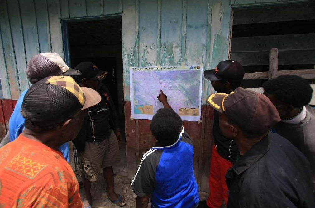 area to be mapped and recognition from the neighbouring land owners. The history of conflicts, agreements and changes in the boundary may need to be discussed by the community members before they agree to make a sketch map of the area. This process may take a long period of time and require facilitation of several meetings until the deal is reached among participants. When they are agree to the area that will be mapped, the sketch map provides a guideline to conduct the technical mapping.
The social process is not limited to acheiving agreement between the community and their neighbours, but also documents the customary institutions, customs and practices, values and norms of the community. This is important because it demonstrates that the customary community which owns the territory still exists, and also confirms that the stakeholders involved in the mapping are those which are recognised as customary leaders and decision makers.
Technical mapping is undertaken when the social process is completed. Technical mapping tools are needed in this process – in the past compass, meter tape, flags and other devices were used, but now an accurate GPS is sufficient. The sketch map made during the social process is used to identify point locations where a GPS reading is taken to create a polygon of the area. The GPS location is important points inside the territory arte also taken, because these will help the community to orientate themsevles when looking at the final map later. At each point, a photo and a brief description is also made, which enables the mappers to correlate points with the locations the community has identified. The field data is processed using GIS Software to produce a digital map with the GPS points that can be cross-checked with the community to verify the boundary.
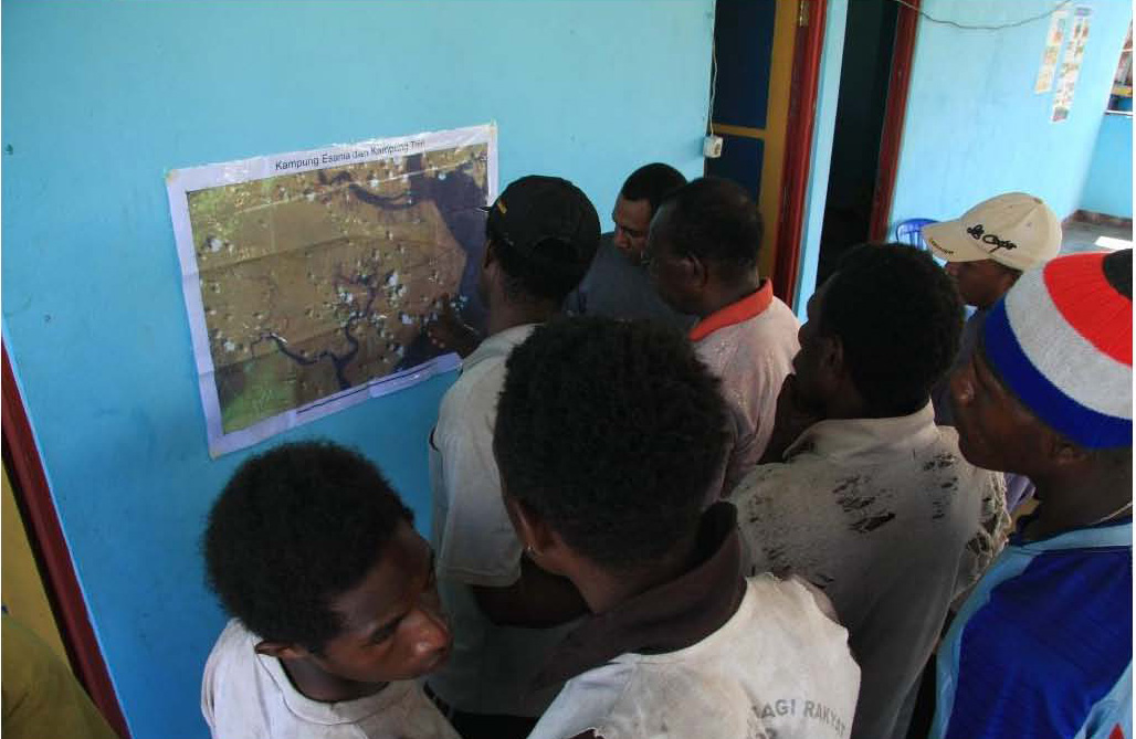
In areas with steep topography or other distinctive physical features, the mapping process may be supported using a good quality satellite image. The image can be used to cross-check the sketch map with the situation on the ground, or to approximately map the boundary in remote areas which cannot be reached by the technical mapping team.
Recognition and legalisation under formal law is the last stage in the mapping process, and has not yet been achieved in Papua. It is important that the earlier social and technical processes are documented, to show the legitimacy of the process when pushing for legal recognition. Communication to build the commitment of the relevant stakeholders is the biggest challenge. The legal route for recognition of maps exists in theory, but has not been tested.
What stakeholders are engaged in Mapping?
“Participatory Customary Territory Mapping” in Papua is being done through engaging several key stakeholders. For example, 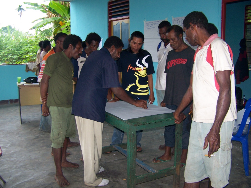 mapping in Baliem Valley involves YBAW (a Local CBO), the forest agency, the national park management unit and the community working as one team to complete the mapping process. For recognition and legalisation, the district Government leader and the district parliament is actively involved.
Another example is from Kaimana, where the idea behind the mapping, as well as to secure rights over a customary territory, is to enable community based forest management (which already takes place according to local customs) to be carried out within a formal legal framework. As a result the key stakeholders have included several parts of the forestry department including the boundaries agency, the water catchment management agency, and the research and development agency. Support is also provided by the District Forestry Agency. The technical and social process is been handled by a Papuan NGO (PERDU) with support from the Indonesian Participatory Mapping Network (JKPP).
What will people do with their map?
The first use of the maps is recognition and legalization of the customary territory. At this stage it is not expected that ‘recognition’ will give full ownership rights. However it should secure the right of the community to be involved in any decisions about development on their land. The best hope from the mapping is that the community will be more confident in protecting their rights once they have a clear map and legal recognition. It is also hoped that Government and the private sector will be more transparent and consultative in their dealing with communities once the boundaries and rights are clear.
The second aim is to enable the community to plan the sustainable management of the resources in their territories. In some areas NGOs have supported the community to make a plan for management of the natural resources in the area they have mapped. Often, communities already recognize a zoning of their land into cultivation land, forest area, sacred places, river and other local land uses, so the plan describes this zoning. Legalization of the management plan is the next task to undertake after the participatory management is agreed.
A third use of the map is where the boundary that has been mapped already is used to apply for a ‘village forest’ licence or other licence by the community, working together with the forestry agency (as in Kaimana). By doing this, the community will have exclusive, legal rights to manage their forest sustainably. This will help to limit the demand for land from plantations, mining and oil investments. In Kaimana the neighbouring villages have asked for help to map their area too, because they believe that the map will help them to bargain more effectively for their rights.
Can the maps that people have now be adopted by the district government to create their district spatial/development plan?
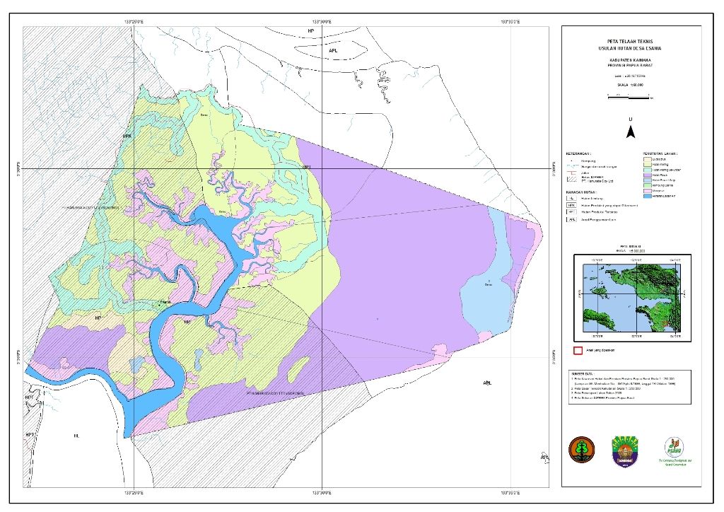 It is important to communicate the results of mapping to the government body that has the responsibility for the district or provincial spatial plan and development plans. This can help to convince Government decision makers that mapping and recognising local communities’ rights is practical and useful. For example, in the new Papua Province Spatial Plan the government has mapped the location of all known settlements. In addition, the law that goes with the spatial plan recognises participatory mapping as part of the spatial planning process for the district level. In response to this, experience from mapping has been used to draft a guideline on conducting the mapping at district level.
In the Baliem Valley, the district government have expressed their willingness to re-align the sub-district administrative boundaries on the basis of customary territories. They recognize that the current administrative boundaries do not consider the customary boundaries. This causes problems when the distribution of the development benefits is not shared fairly within the community. If sub-district and customary boundaries are aligned, it is hoped that distribution of development support to communities will be more effective and fair.
What rights do people have when their map is approved?
Whilst this is not yet final, it is hoped that the rights that people will have when their map is approved are:
First, the right to be recognised as the land owner culturally and be registered legally by the Government (district, provincial and national). This is particularly important for territories inside and around state forests.
Second is the right to receive and accurate and correct information about the development plans which affect their territory, and the right to have a say in these plans. In addition, people also have a right to participate actively in any kind of development that is undertaken on their territory.
Third is the right to get legal permission to sustainably manage the resources in their territory under government licenses. Indonesian law requires parties including communities who want to manage resources in state forests to get a licence from the government.
Fourth is the right to get the benefit of the development fairly and equitably, including compensation from land use investments. Learning from previous experience with forestry concessions shows that this is often not the case.
Can the whole of Papua be mapped? What are the Challenges and opportunities?
Challenges:
Inadequate capacity, especially human resources to support the mapping process. Social process facilitators, GIS experts, and funding from Government and other sources are all inadequate.
Quality of the mapping processes. The technical process of producing a map is an essential part of the process, but does not guarantee a good map. A good map needs to be built on a carefully facilitated agreement, and a process of verification by the community so that they own the map.
Gender and marginal group issues. With more than 250 tribes and traditions in Papua it is a challenge to accomodate gender and marginalised groups in the mapping processes. A mapping process needs to have a process that enables marginalised and women’s group to participate in the processes. This will influence the quality of social mapping.
Large areas and long time processes. With total area about 890,000 km2 and a large number of tribes, limited capacity and limited funding, it will require a long time to finalise maps for whole of Papua.
Opportunities:
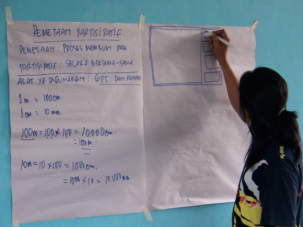 There are now opportunities to legalise the recognition of customary territories in Papua. There is an agreement betwen the national land body (BPN) and the IP’s alliance (AMAN) to register all customary territories in Indonesia that have been mapped. On the provincial level Papua has a special regulation on recognition of individual and communal right to the land, and a special regulation about sustainable forest management which includes the mapping and recognition of customary forest rights.
Another opportunity for customary mapping is the recognition of settlements in the Papua Spatial Plan. There accompanying provincial regulation mentions customary mapping as one process that should be conducted at district level before they finalize their District spatial plan.
What risks are there from making and having maps?
It is important to realize that there are risks when people have maps, even though mapping is intended to be a tool to accomodate, clarify and recognize the right to reources. Some risks that been indentified during the mapping experiences in Papua are:
– Mapping may be used by communty elites to show or promote their area and its resources to an investor
– Process capture by elites, so that the final map represents their version, or so that they can use the map for their pown interests.
– The map may help an invetor to see who can be bought or intimidated to get agreement for a licence application.
– Dynamic and complex norms and traditions could be ‘frozen’ by mapping. Customary values are based on interaction with nature, and are dynamic and adaptive. In addition, several different rights to own or use an area of land of resource may exist simultaneously in the same area. There is a danger that mapping ‘freezes’ the adaptive dynamism of customary practices, and extinguishes some overlapping rights. [Yunus Yumte|Papua Program]


Leave a Reply
You must be logged in to post a comment.